25 February 2021
Leading specialists of the Department of “Research and design of roads, geodesy and land management” took part in the webinar: “Scan2BIM – Hexagon laser scanning technologies for BIM in practice”
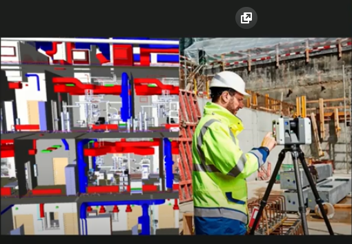
Laser scanning technologies have been developing rapidly in recent years, with the main consumer of scanner results being the BIM industry.
The webinar covered:
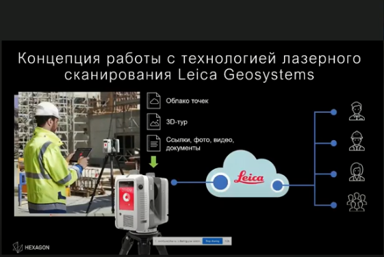
- laser scanning in BIM: what it is for and in what cases it is possible to use;
- what type of laser scanner is most effective;
- how to create a BIM model based on the obtained point cloud;
- technical requirements for the quality of the point cloud.